Space Projects Incubator of the Czech Republic
Satellite of the Sentinel mission
One-third of the planet’s landmass is used for agriculture. It comes as no surprise, since almost 8 billion people call planet Earth home. With the growing amount of stomachs to fill, our planet is under immense increasing pressure to produce more and more. Erosions and exhaustion of minerals are now reinforced by draughts. Not even the oceans are spared the high demand of the human appetite.

Earth, however, is not an automated conveyer belt for producing bread, it is a living organism, therefore, food production is influenced by many everchanging factors such as temperature, draught, oceanic currents and gyres, floods…
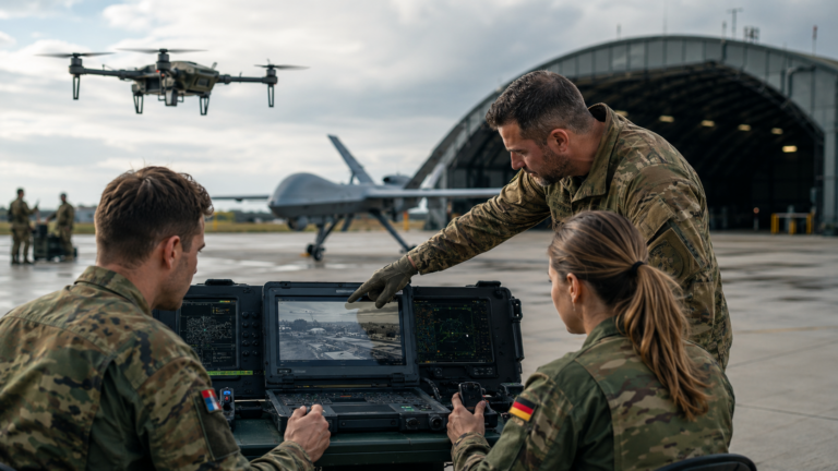
It became increasingly crucial to optimize the way we eat, in order to sustain as much as we can. It is this optimization, that is under the lens of the most modern satellites orbiting under the control of the European Cosmic Agency. Optical and radar sensors provide an accurate image of the agricultural acreage intended for various crops, their well-being, and their ripeness. Thanks to the increased accuracy of reporting, the agricultural practice improves. Each field can be thoroughly documented, which allows for more intensive and efficient cultivation. Corn can be deemed suitable for some fields, while wheat for others. We know what to plant and where to plant it thanks to satellites, that orbit 700 kilometers above all the crops they help cultivate.

Outer space data for our farmers
There are Czech projects under the incubator of the European Cosmic Agency, the ESA BIC Prague, that focus on optimizing data from outer space. Some of them help farmers and fishermen to get a deeper understanding of their local state of fauna and flora. The data gathered then serves as a basis for further decision making. A startup called World from Space for example examines several basic parameters of agricultural soil: density of crops, amount of leaves, and light absorption (which allows insights about the moisture and ripeness of crops).
Thanks to those insights, the farmer knows which parts of his land are doing good, where the land is dry, and where the land requires fertilizing. Each field can then be categorized based on fertility, irrigation, and its progress over time can be visualized.
It‘s like boiling vegetables
The processing of satellite data is not unlike boiling root vegetables. Instead of let’s say carrot, we work with the relative SMI index, which measures the humidity of the soil and is calculated using the Sentinel-1 satellite. So-called RAW data are sliced into the CHOPPED data that covers the resolution valid for an area of 10 meters. This data needs to be aggregated, to eliminate the inaccuracies stemming from reflections and merging of signals. By doing this, the CHOPPED data is „boiled“ into the state of COOKED data.
The World from Space company calculated the SMI index for agricultural purposes directly targeting specific fields, as we can see in the last visualization. The image shows the data in the „SERVED“ stage, the final stage of data preparation. Each field is perpetually monitored in an interval of 1-3 days. The cuisine terminology is actually used by the scientific community to describe the stages of data.
Against heat in the city
The magic that satellites can pull off goes further. World from Space is able to map the greenery not only on agricultural land but also within cities, using the Sentinel-2 satellite. Why would they do that? The reason is the fact that lives become significantly better when greenery plays a role in the concrete jungle. It reduces dustiness, improves the state of the atmosphere, accumulates water, cools down the environment, reduces noise, and to top it off, it creates oxygen in the process. Thanks to the data collected by the Sentinel-5 satellite, the company maps the long-term density of carbon dioxide above our Czech capital for example. The help coming from the Czech Republic is not only aimed at the Czech regions. Startup Big Terra has done several projects targeted at Africa and various locations in Europe – Moldova for example, where agriculture amounts to 40% of the national GDP. Moldova is one of the poorest European countries, but at the same time, the country benefits from having very fertile chernozem, whose potential was partly discovered by the Big Terra company. The company showed areas of high harvest potential, profitability, statistics, and climatic trends in the region by using technical analysis and growth simulations.
“Blessed Sentinel”
An example of the chernozem area is a region in close proximity of Kišiněv, Moldova, in the Serpeni area, where a centralized irrigation system channels the water from the Dniester river to the local fields. The Sentinel-2 data and the initial RGB visualization shows the area in a way a human eye would see it. The second visualization shows an estimate of the area covered by leaves within certain vegetation – the title of the largest leaf area belongs to the woods near the Dniester followed by the area irrigated by the watering system. The third visualization shows the NDVI (Normalized Difference Vegetation Index), which measures the amount of greenery in a given area. The fourth image shows the NDWI (Normalized Difference Water Index), which measures the amount of water present in the plants – called green water. The last image shows the Subset Infrared visualization that measures the amount of reflected infra-red rays, the majority of the reflection is done by greenery (chlorophyll specifically).
Based on this data, the Big Terra company created an advanced analytical tool useful for floral production, which evaluates timewise and spatial trends in the course of the growth of the crops. The company focus also turns towards African countries, they give advisory to Zambian farmers and NGO’s on when and where to plant. We are obviously operating within the realm of probabilities, and even with the help of satellite data, we cannot assume where it will rain and on which field with certainty. What we can say though, is that the harvest will be the most productive, if we plant the seeds of wheat in October and we do so in the Northern regions of Zambia.
The Galileo ESA BIC system aims to evolve projects that combine Sentinel satellite data, orbiting above our head in the height of 700 kilometers, with the data coming from navigational satellites, that orbit 20 thousand kilometers higher. One of those satellites is the European Galileo system.
When there are too many fishermen
A startup incubated in the Czech Republic, Numer8, comes from India, where fishing gives jobs to 14 million local citizens. Due to the presence of large corporate fishing ships, that have a nearly unfillable steel stomach, overfishing occurs. Due to overfishing, extinction of species and devastation of seas and oceans happens.
The Science magazine forecasted the collapse of the fishing industry by 2048, due to unregulated overfishing. One of the forces that aim to prevent this outcome is the Numer8 startup, which tries to give power back to the hands of local fishermen. Thanks to data on ocean temperature and the amount of chlorophyll, acquired through the satellite monitoring of planet Earth, the startup is able to predict where there will be fish to hunt. Local fisherman can find this crucial information through a mobile application, and head out there for a certain catch. The application utilizes the navigational satellite data as well. When a certain location is being fished by too many fishermen, the application hides it from the rest of the fishermen. In a similar manner in which Google Maps purposefully shows incoming traffic, the Numer8 app hides an area with too many fishermen fishing.
Data can handle the population growth
Thanks to the work of ESA BIC Prague incubator, and the projects evolving under its wings, the work with data becomes increasingly more reliable, more accurate, and the efficacy of fishing in oceans and agriculture on the fields increases, while city life improves. Global prosperity, safe access to food, and climatic resilience have become increasingly improved. The number of humans on the planet will by no means decrease in the near future, however, there is increasingly more useful data orbiting the Earth, that can help us back on the surface to handle the situation at hand.
Cosmic incubator ESA BIC in Czechia
The unique cosmic incubator has been helping selected startups in the early stages of entrepreneurship ever since 2016. Since then, 31 projects have been added to the portfolio, and all of them found a real use-case of cosmic technologies in our day-to-day lives. Among the projects supported there are stratospheric stations, luxurious light bicycles made from cosmic materials, satellites, drones, and algorithms to calculate the propagation of errors and uncertainties. The incubator gave birth to diagnostical technologies, that process sound and to an x-ray device that verifies the authenticity of artworks. In short, the incubator helps projects that combine cosmic with entrepreneurial ideas utilizing cosmic patents, navigational systems, or long-distance imaging of planet Earth. ESA BIC Prague is operated by the agency CzechInvest.
Text by: Kateřina Syslová, ESA BIC PRAGUE
Photos by: ESA BIC PRAGUE, World from Space, BIG TERRA